Helpful Links
Here’s some links that have been found to be useful to the DBC, or riders in general:
- Dips Strava Club: Most of the DBC members have a Strava account. The added benefit is that there is a DBC Strava Club, which is useful for friendly DBC competition, or club events.
- Jay’s Essential Bike Rides: This website is one of the most comprehensive sites for information about most of the rides that are available to the DBC.
- Ride With GPS: This is a great website for planning and building routes. There are several out there, but this one allows you to directly load the route into most Garmin head units (like the Edge 520, 820 or 1000)
- Western Wheelers: This is another great resource for local rides, although this one is all about the climbing!
- Standford Cycling Team: A comprehensive list and description of local climbs, including the lesser known, such as Westridge, Joaquin, Jefferson, Godetia, etc.
- Water Stops: Here’s a Google map that shows public water available in the Bay Area. It’s probably not comprehensive, but still a good resource.
- Beginner’s Guide To Cycling: This is a great resource for beginning riders that was suggested by someone that stumbled on to our site and used it to help her daughter get into cycling. (Thanks Morgan!)
Routes
Here’s some of the routes that make up the DBC staples for weekend rides. Click on the name to go to the ridewithgps.com site so you can get more details, as well as export a file to load onto your Garmin.
-
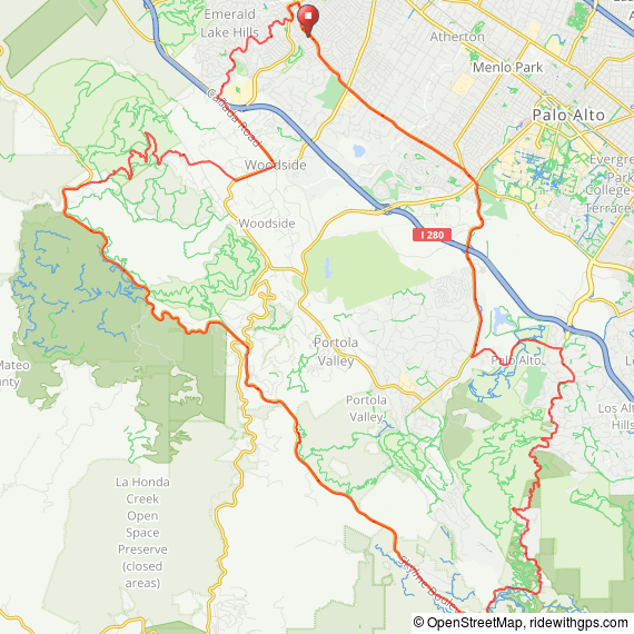
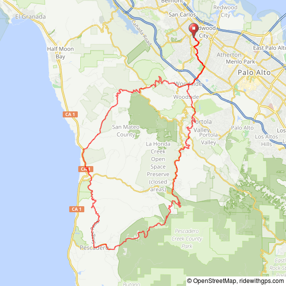
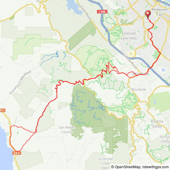
Pescadero Bakery Ride
61.4 miles, 6,070 ft. elevation

Otherwise known as the Coast Ride, this is one to test your climbing legs, as it climbs OLH, Pescadero (Haskins), the 3 “bumps” on Stage, and Tunitas. The stop at Arcangeli Bakery in Pescadero for some famous artichoke bread makes it all worthwhile!
67.1 miles, 5,336 ft. elevation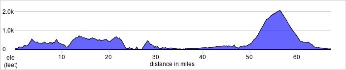
An alternative to the Pescadero route, this one usually has a stop for lunch in downtown Half Moon Bay. It avoids any major climbs to the top of the ridge, and really only has Tunitas as the lone major climb.

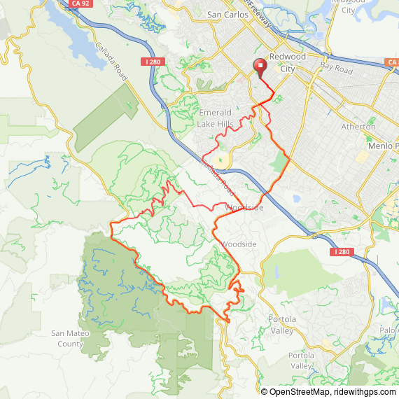
28.3 miles, 2825 ft. elevation
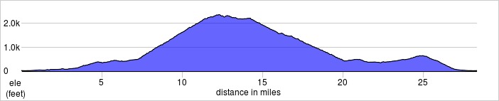
A nice quick loop, straight up King’s, then south to 84 for a great descent (when there’s no roadwork). Since it’s a quick ride, we like to come back over Jefferson and enjoy that descent as well.
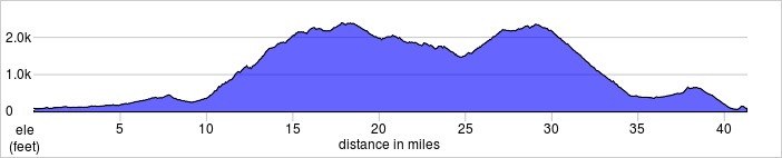
42.4 miles, 4542 ft. elevation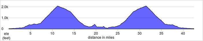
The quickest way to the coast, it still takes you past the Bike Hut for some refreshments and relaxation before tackling Tunitas. An option is to come back via Lobitos Creek, for an added climb.
Page Mill Climb
41.3 miles, 4332 ft. elevation
The most grueling climb east of Skyline, it’s not only long, but has some long exposed sections; fortunately, there’s a couple of breaks in the climb that make it doable. From Skyline, there are several options, but this particular route goes north on Skyline to the top of King’s Mountain (another climb!) where we descend back down to the flatlands.