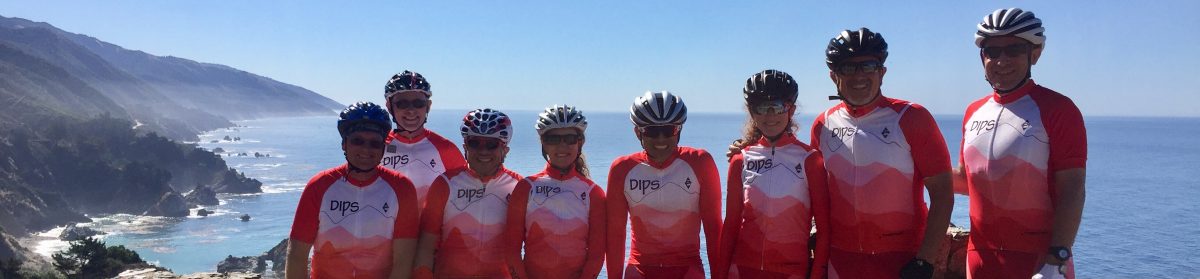
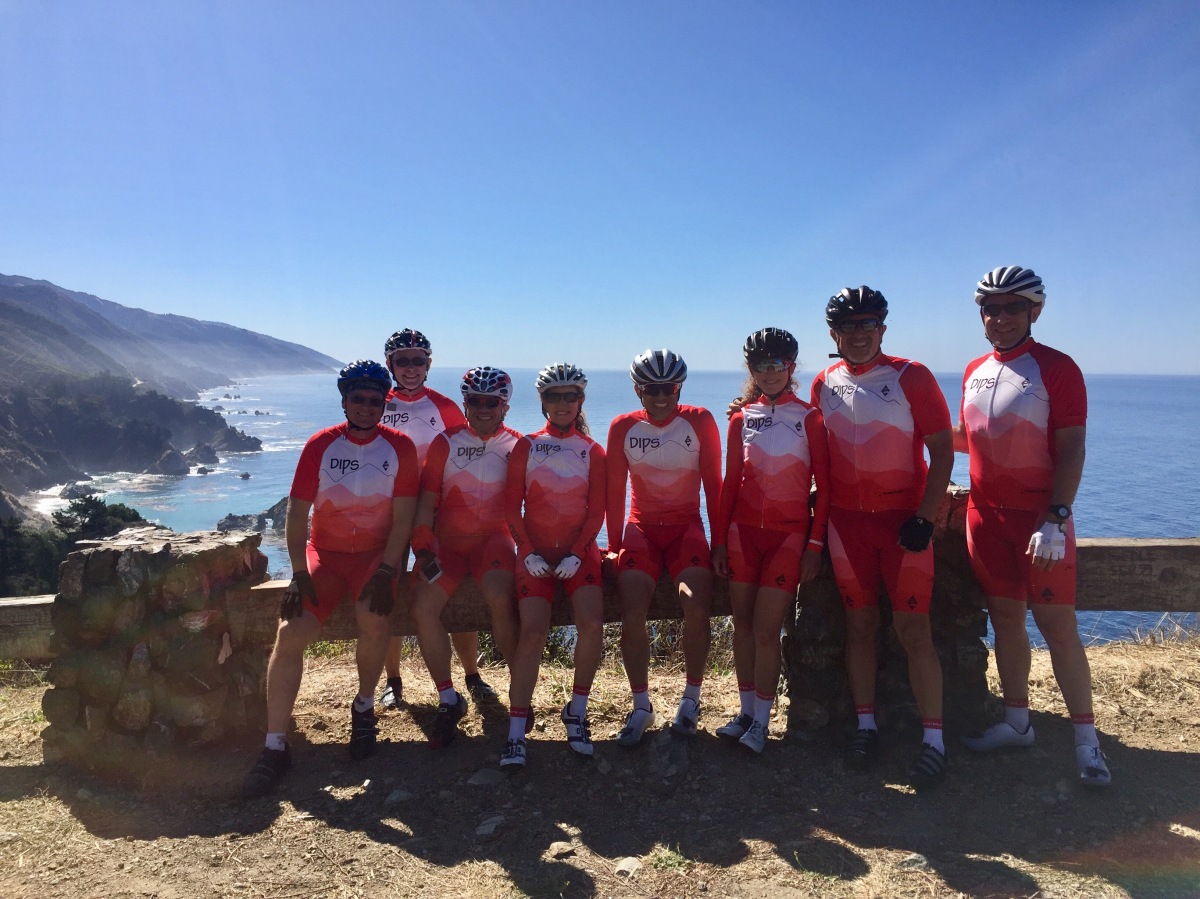
This past Sunday, 14 of the Dips took a rare opportunity, and came away with an unforgettable experience.
The rare opportunity was a chance to ride Highway 1 south of Big Sur with the road basically bracketed by a closed bridge to the north (about a mile north of Nepenthe), and a major landslide blocking the road some 35 miles to the south; with only Nascimento-Ferguson Rd feeding this section, traffic was about just a fraction of normal.
The unforgettable experience was brought about by a combination of absolutely unbelievable weather, active marine wildlife, good food, and the company of a great group of riders.
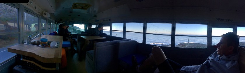
The day started at 6:00 am at the Page Mill Park-n-Ride with many of the riders opting for the infamous Dips Bus Experience, a converted school bus that Steve borrows from his son every now and again. Many of us have had memorable bus experiences, while others have experiences they would rather forget, but the photos keep surfacing! I was co-driving in Susan’s car, so avoided any embarrassing bus moments, but maybe others can chime in with any in the comments.
Once we arrived at Big Sur Park, we discovered that we weren’t the only cyclists looking to enjoy the road. It looked like a parking lot at the start of a century, with lots of bikes and riders. The only difference is that nobody had road shoes on, but rather something more suitable for walking the Community Bypass Trail, which was built for the sole purpose of allowing residents of Big Sur to be able to get around the closed bridge.

The trail itself was very impressive; it was a well-built trail, especially considering that it was built in such a hurry. I read that a lot of the community residents volunteered to help build it, so we made sure to let them know how much we appreciated it whenever we came across one on the trail. It wasn’t that easy to negotiate though, with lots of railroad tie steps and a creek crossing. Those with light bikes definitely had an advantage!

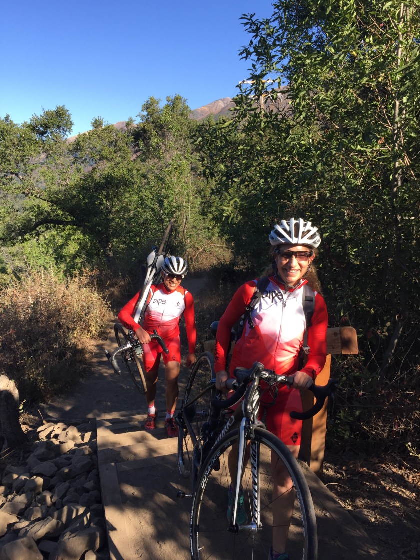
Once we got off the trail, we ended up on a rather narrow road, filled with construction equipment and parked cars. It took us a moment to realize we were actually on Highway 1, which looked like a single-lane road. After changing shoes, we headed south to Nepenthe to hide our backpacks for our change of clothes after the ride. While we were at Nepenthe, we were joined by other riders looking to stash their backpacks. I’m thinking that during the day, there was probably a backpack behind every bush in that area.
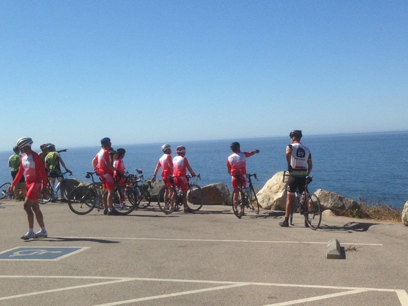
With the backpacks stashed, we could begin riding in earnest, and we didn’t ride long before the splendor of the day hit us with the first vista point. The parking lot was empty of any cars, and it felt like we had it all to ourselves. The views were breathtaking.
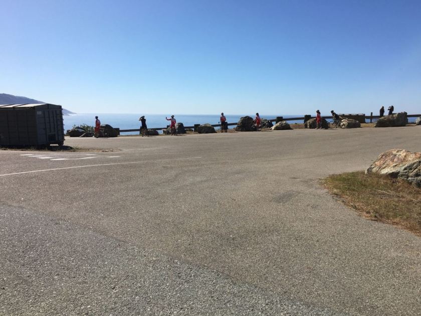

This first stop set the stage for the rest of the ride, which was rolling hills, interspersed with spectacular views. None of us were disappointed having to stop and collect, as it gave an opportunity to take in the scenery.
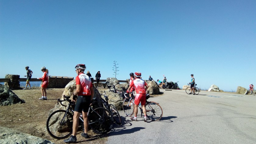
At the next vista point, a bit further down the road, the views were just as spectacular.


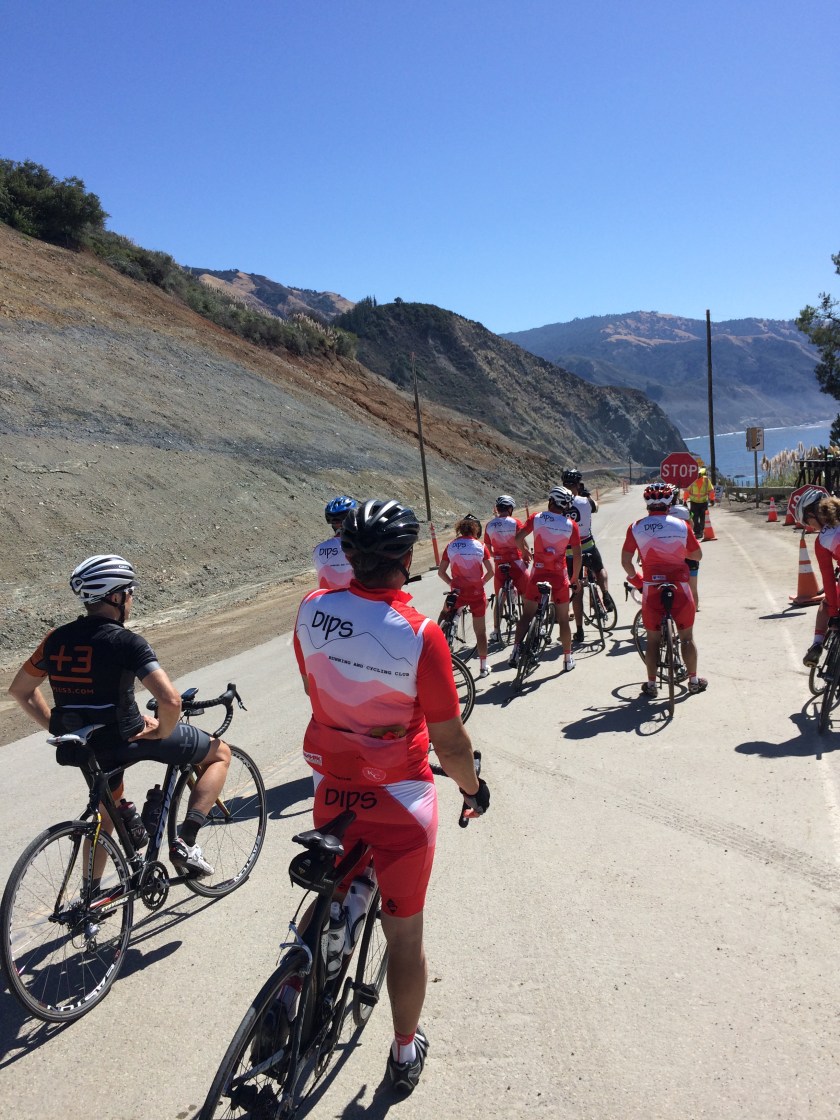
There were a couple of controlled stretches of roadway, the first was where the Fire Department was doing a car accident reenactment drill, with a car parked in the middle of the road, and this second one was where it appeared they were doing some shoring up of the land wall after clearing a slide.
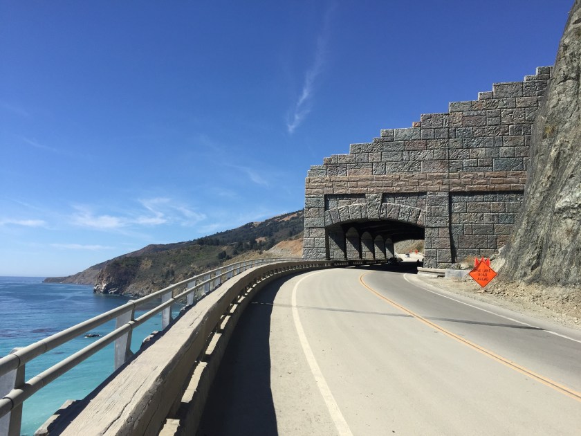
It’s hard to see in the last picture, but in the distance is the Rock Rain Rock Shed, which is like a snow shed, except for rock slides. It looked very cool, and there were some great ocean acoustics when you were inside; of course, only really noticeable when you’re on a bike!

After about 3 hours after starting, we arrived at the end of the road; a gate, with a guard that prevented us from actually riding to the slide. The guard did have some impressive photos of the slide, which showed just how massive it was. He said it basically created 15 new acres of land that the government was quick to claim!


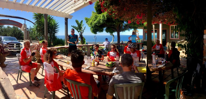
Conveniently, at the end of the road was the Whale Watcher’s Cafe, our lunch stop for the ride. Given the reduced number of customers due to the road closure, we were treated like celebrities. I called them before the ride, so they knew we were coming, and they barbecued tri-tip “just for us” which made for some delicious sandwiches that most of us ordered. Just a side note, the sandwich was delicious, but a little heavy for a mid-ride meal, and many of us were feeling it on the way back north.

While we were eating lunch, many of us were nervously anticipating the notorious headwind that we knew awaited us on the return ride; in fact, we went out of our way NOT to mention it, for fear of a jinx. Yet as we headed back north, there was no headwind to speak of, and it wasn’t until we were in the comfort of Nepenthe, eating dinner, could we finally talk as a group about the miracle of the windless Highway 1 ride, in BOTH directions!
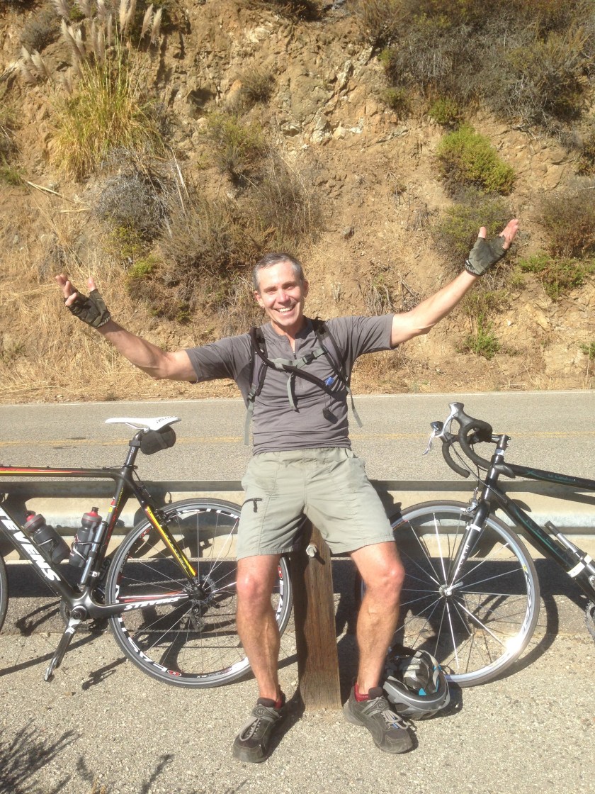
On the return ride, there may not have been any headwind, but there was a painful bee sting, a blowout, a crash, and a chain drop. While you may think this is about average for a long ride with 14 riders, you may be surprised to find that all this happened to Eduardo. We owe you Eduardo for taking one for the team and channeling all of the bad luck onto yourself. We also sincerely hope that you find better luck on future rides.
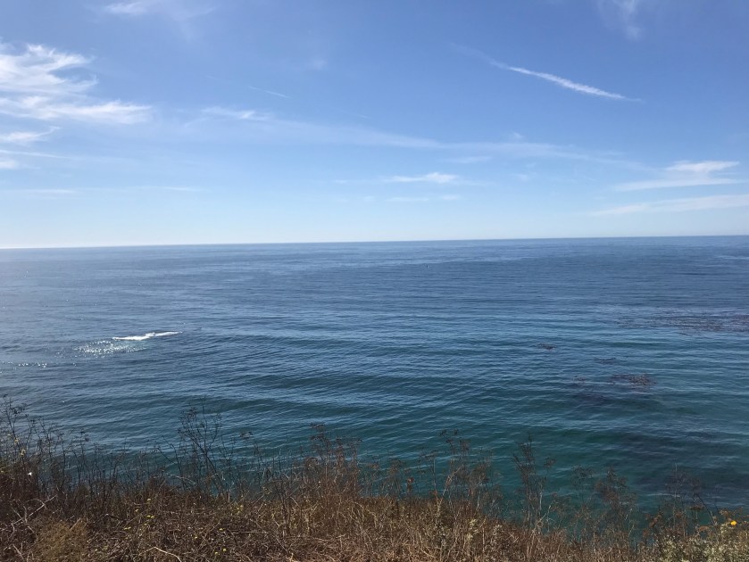
It wasn’t all bad luck on the return ride. As we stopped at one of the vista points to collect, we looked out onto the ocean and found multiple whale spouts every 15 seconds or so. There were rumors of whale sightings on the ride south, but nothing as reliable as what we were viewing at that vista point. We even saw a whale breach, not once, but probably 3 or 4 times, and very close to shore. Jorge managed to snap a picture just after it splashed down.
After the whale-watching stop, we continued north to a spot where Steve said he was able to see Pfeiffer Falls. We were dubious, but Steve led the way and sure enough, the view was spectacular from the road.

After Pfeiffer Falls, we knew we were close to the end, and we had dinner reservations at Nepenthe at 5:00 pm, so with that, we rode hard the final few miles and rolled back into the Nepenthe parking lot to retrieve our bags from the bushes; fortunately, they were all just where we left them.
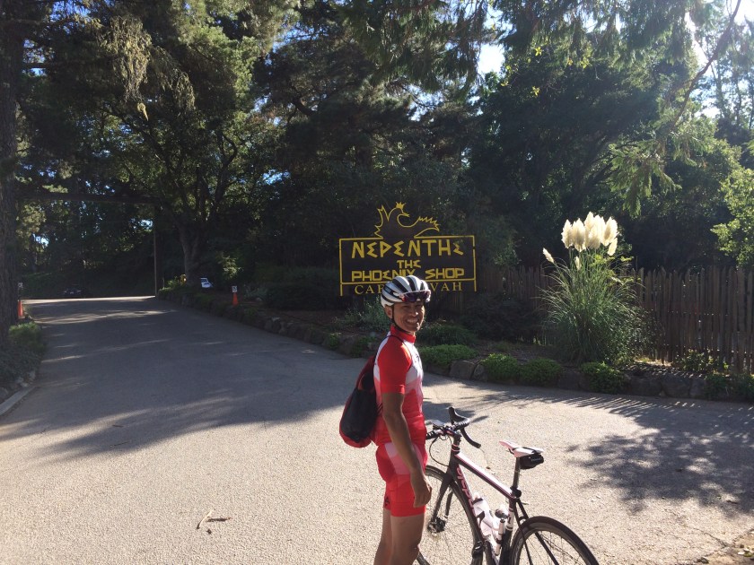
Nepenthe was like I’ve never seen it, quiet, almost intimate, with just us and a handful of other parties there. Out of our bike kits (most of us) and relaxed, we were brimming with the afterglow of a fantastic day on our bikes, and we shared our favorite parts over drinks and a good meal. Susan, Anna and I even got Happy Birthday mugs from Nepenthe! Did I mention it was actually their birthday?


It was truly a day to remember. Thanks Marty for suggesting this, and arranging for dinner at Nepenthe. I think we all would have kicked ourselves had we missed this opportunity for a once-in-a-lifetime ride.