Donner Pass Ride Report

For those that don’t know, the Dips often have access to houses and cabins in fantastic locations for away rides. For example, the Near Death Ride was only made possible by Mike B’s gracious offer to use his cabin in Arnold as our home base for the event.

Susan, another Dips rider, has a place at Truckee Donner, and she also offered up room for anyone that wanted to head over for a ride. I found I was free, but only in the middle of the week, and despite my offering, nobody could play hooky and join me. Undaunted, I headed up anyway, knowing that at least Anna was there to help classify it as a “group” ride.

The weather was absolutely spectacular when I arrived; clear and warm, without any hail in the forecast. After suiting up, we headed down the hill to Donner Pass Rd. I say “down the hill”, because for anyone that’s been to Tahoe Donner, there’s a steep climb up from Donner Pass Rd, with sections up to 14%. We’ll worry about coming back up later, but for now, it was a straight, fast descent to the bottom.

As we rode past the piers at Donner Lake, we spied them longingly because we knew there would be a good chance we’d be lounging on one and drinking beers after the ride, but for now, it was time to climb.

The climb itself wasn’t bad, about on par with Old La Honda or King’s, the difference being the spectacular views of Donner Lake as you climb higher and higher. As we neared the top, we paused at Snowshed, which is crag popular with climbers, and happened to be where Anna’s husband, Zach was climbing that morning. Here’s the twins seeing if they could spot him on the wall.IMG_20170830_102926

And here they are with the lake in the background:IMG_20170830_103042

And me.

IMG_20170830_103120

After chatting with Zach for a bit and making plans for after the ride, we headed back up, but it was only a couple of more turns before we reached the official vista point.IMG_20170830_104950

As we rode on over the summit, we continued on Donner Pass Rd, past Sugar Bowl (man it looks different in the summer), over Hwy 80, and onto a great 10-mile stretch running parallel to the highway all the way to the Cisco Grove campground. Despite the sounds of the highway, the road itself had very little traffic, and judging by the number of bikes, provided a popular bike route in the area.

Once we arrived at Cisco Grove, we enjoyed a snack before turning around. Before leaving, we were surprised by the sight of a helicopter dropping off a power pole just about 50 yards away from where we were sitting.IMG_20170830_115503

By the time we rode back, we had a tail wind, which was great all the way back up to Donner Summit, but it made for a white knuckle descent for me, as the tail wind became a crosswind at times, and pushed my front wheel back and forth while I was trying not to ride off the cliff, or into oncoming traffic.

Back safely on the flats, we decided to forego the 14% climb back up to Susan’s place, and opted for a much more scenic multi-use trail that began in downtown, and weaved its way up the hill without any cars to disrupt the natural beauty of the area.

Once back at Susan’s, it was a quick shower, lunch, and time to head down to drink some beers and relax at the lake. The highlight for me was a dachsund that reminded me of my recently departed wiener dog.

IMG_20170830_161728IMG_20170830_162225

It’s a shame it was just the 3 of us this time, hopefully more Dips will be able to make the next Truckee away ride!

The Near-Death Ride

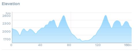
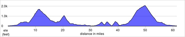
Ok. So I’m exaggerating, but I thought I was ready for the challenge of the Ebbett’s Pass Century, but I couldn’t have been more wrong.

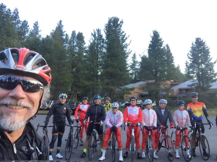
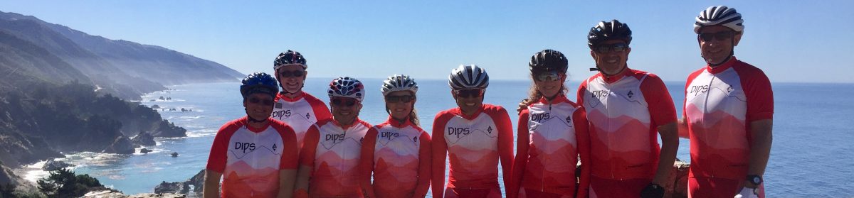
The weather was perfect as we gathered at Bear Valley for the start of the ride. All told, it was Paul, Mike B, Eduardo, Tom, MJ, Jorge, Susan, Marty, Anna, Chris, Jeff and Jason. Sorry Jeff and Jason, looks like Paul needs some work on his selfie skills because you two slid off the group shot.IMG_2770EPC Start

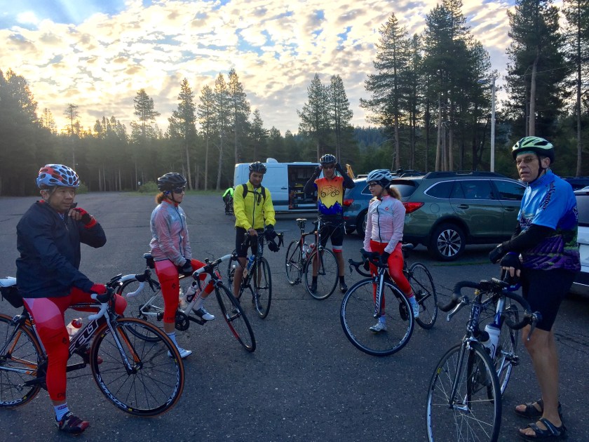
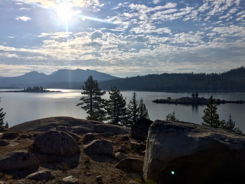
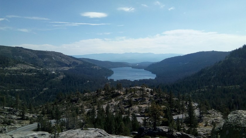
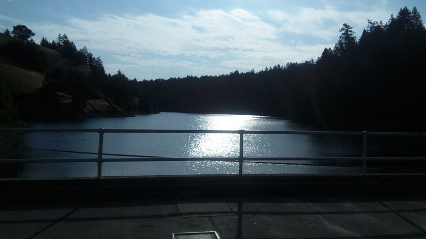
Before heading east to the major climbing, we headed west to Spicer Reservoir for a beautiful view of the sun rising up over the water. It was a an awesome ride on Spicer Reservoir Road, with fresh legs and hardly any vehicles. We got our first stamp (out of 4) on our “passports”, fully anticipating we would collect all of them before the end of the ride.IMG_5865

IMG_2772

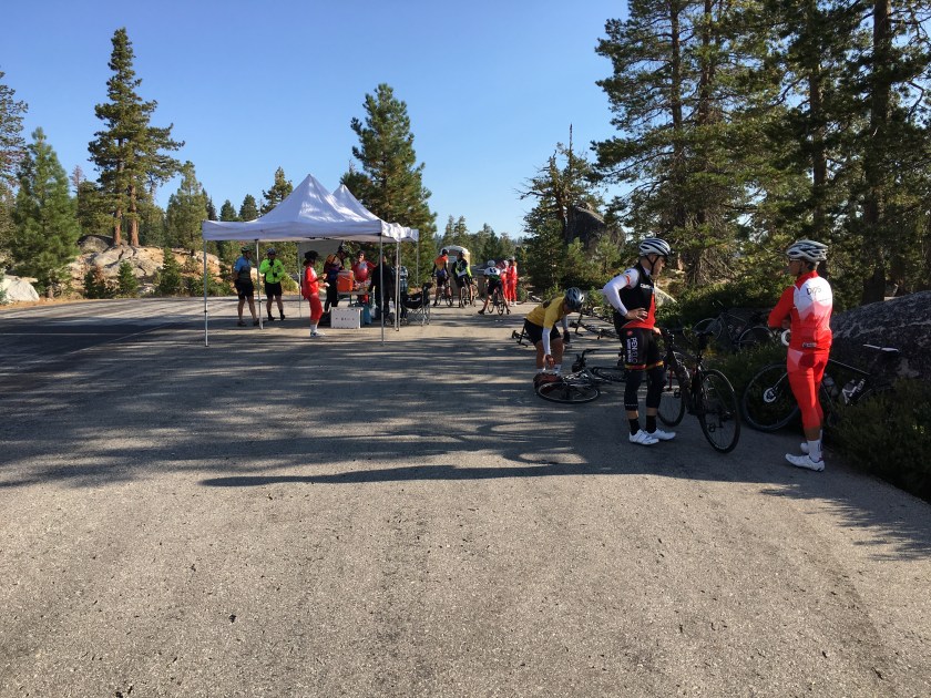
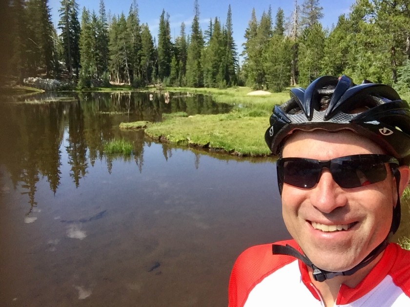
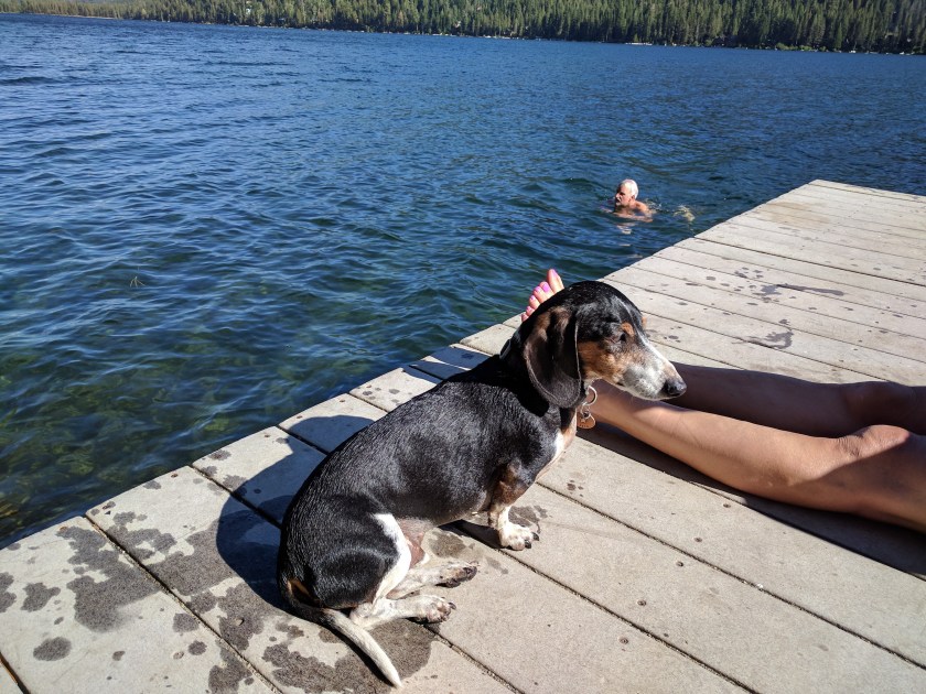
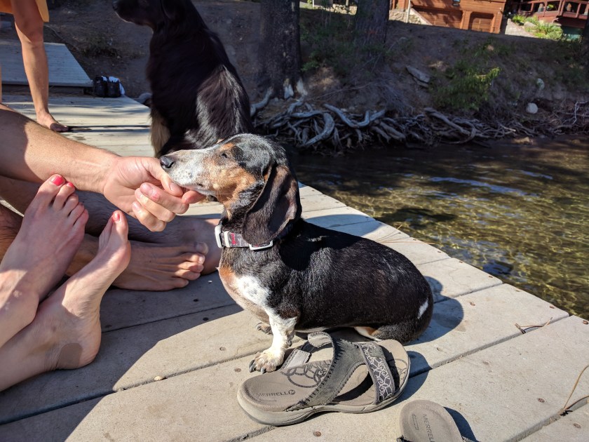
Here’s a shot of Marty and I looking like the Creatures of the Black Lagoon emerging from the water.IMG_5863

After refueling, we headed back to Bear Valley, already having wiped out a quarter of the miles for the day. Feeling good, we unloaded any extra clothing since it had warmed up nicely. There wasn’t any need for that jacket anymore, right? And full-fingered gloves? That would only take up valuable jersey pocket space.

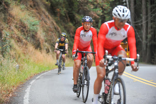
As we headed East towards the real climbs, spirits were high, and and climbing up to the Mosquito Lake aid station was amazing, with roads that seemed to be made for cyclists and a gentle grade to another beautiful alpine lake.IMG_2784IMG_2789

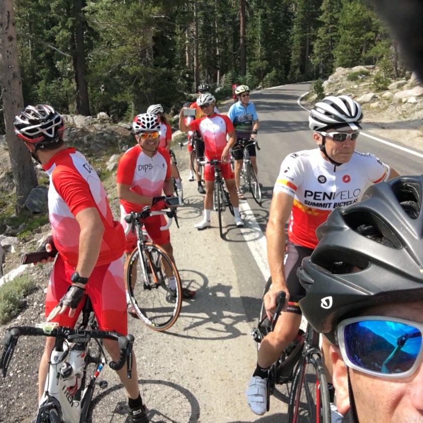
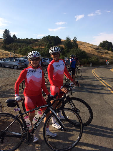
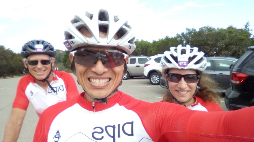
Here’s the Dips ready to roll out from the Mosquito Lake aid station. We were looking forward to more beautiful riding ahead; after all, look at the phenomenal weather at the lake!IMG_2790

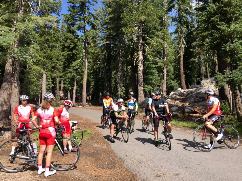
Right after leaving the Mosquito Lake aid station, we were set to descend Pacific Grade, with its’ infamous section of 24% grades, it was fun going down, but we also knew we would have to ride back up it. . . or would we? But before descending, we stopped to drink in the spectacular view of Hermit Valley and the glorious weather we were enjoying.IMG_2791

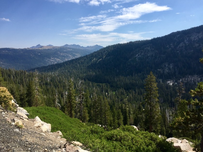
In the next two shots, the first one is a picture I took of Tom while he was taking a selfie, and the second shot is Tom’s selfie he was taking.IMG_20170819_104041IMG_5867

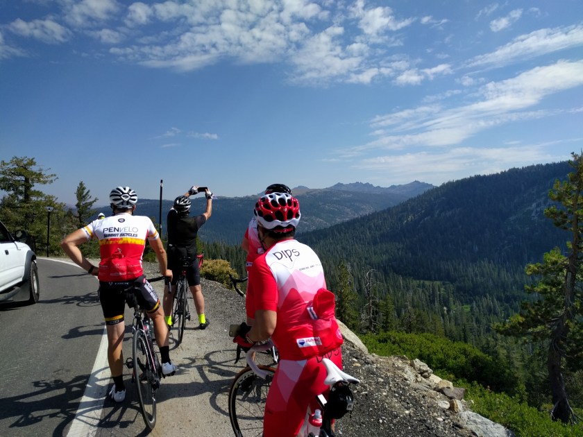
The descent down Pacific Grade was fast, twisty and fun, and after the briefest of flat sections at the bottom, we began the climb up the western side of Ebbett’s Pass. It was a tough climb, but everyone climbed at their own reasonable pace, and mine matched up with Tom’s as we kept each other company while we marched up the mountain.

We felt the first raindrops with just with about 3 miles to go until the aid station at the summit. We knew there was a 35% chance of thundershowers, and a few clouds had formed overhead, but we had difficulty determining which one even looked remotely like a rain cloud. Putting that aside, we put our focus back to the task at hand, which was turning our pedals up towards the top.

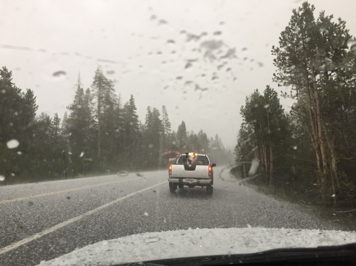
With about a mile to go, the random raindrops began to get more organized, and by about a half mile to go, it began to rain in earnest. As we reached the aid station, the hail started and the temperature dropped about 10 degrees.

IMG_2792

So that was the bad news; the good news is we were under a canopy, Sierra storms usually pass in about a half-hour, and this aid station had camping chairs, Oreos, and espresso! So while we huddled to stay warm, we contemplated our situation and some choices began to form: 1.) Go west, with a wet, rainy descent back to Bear Valley and a warm car; or 2.) Go east with a wet, rainy descent away from the car towards Markleeville and our next stamp for our passport. In true Dips fashion, we realized that we had to try to finish the ride; what we didn’t realize was that while were walking around in the rain-soaked ground, some of our cleats were filling up with a wet past of Sierra mud that made it difficult to clip in for some, and impossible to clip out for others.

It took a while, and it splintered the group, but eventually everyone was able to roll out down the eastern slope of Ebbett’s except for Susan, who actually had to take her foot out of her shoe to get off her bike. After being unable to get her cleat to function properly after a lot of effort (thanks to Jason), she begrudgingly called it a day and took a SAG wagon back to the car. Later, she would realize that it was the best thing that could have happened to her.

The descent down the eastern side of Ebbett’s was truly wet and treacherous, but only for the first couple of miles, then in true Sierra form, the rain stopped and the roads miraculously dried immediately, and we were left with one of the most spectacular descents in recent memory. After reaching the bottom, there were several miles of a slight downhill grade that made it easy to hit 25 mph spinning easy in your highest gear, reaching a beautiful river at the bottom of the valley.IMG_5872

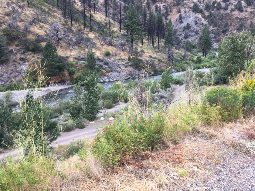
I had done the entire descent by myself, and was happy to spot Tom taking pictures of this river, and together, we headed towards Markleeville and our next stamp, but not before stopping at this spectacular view of another river valley that looked straight out of a Hollywood western.IMG_5874

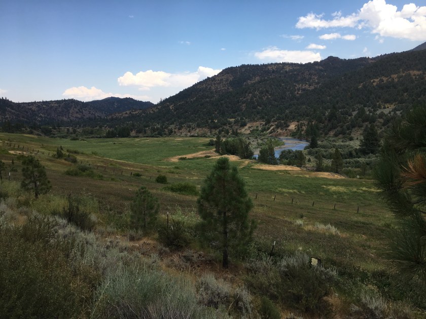
When we got to the Markleeville aid station, we found Mike B, Paul, Marty, Jeff, MJ, and Chris. The food at the aid station was seriously lacking, but we did get our stamp, and MJ gave us a handful of delicious bacon from his bike bag (seriously). As we headed back towards Ebbett’s, other Dips began passing us in the other direction. First there was Jorge, who waved and continued towards the aid station, followed by Anna and Jason, who decided to forego the next stamp at the aid station and turned around to join our group on the climb up Ebbett’s.

The climb up the eastern side of Ebbett’s is long; remember that gradual downhill that made it so easy to hit 25mph? It works against you on the way back, and by the time you hit that cow guard that marks the “real” climb, you’ve already blown some matches. So as Paul, Anna and Jason started gapping the rest of group, I stayed with them for a while, before realizing that I still had the infamous 24% grade of Pacific Grade to contend with, so I backed off and drifted back down, first to Chris, then to Jeff; this is when the rain started again.

This time, there was no sneaking up on you, the rain just came, and came hard. I was quickly soaked to the skin, and stopped to pull my arm warmers up (a little too late). Pulling up wet arm armers over wet arms takes a bit of time, and afterwards, I decided I may as well wait for the next Dips to come up the hill so I’d have company for the rest of the climb. That next Dips was Tommy and he was great horse to hitch my wagon to. Tom was determined to do the full 100 miles, and nothing was going to deter him, so once again, the two of us matched pedal strokes up Ebbett’s, this time on the other side.

As we climbed, I was having flashbacks to the infamous aborted Lake Tahoe ride in the freezing rain. I was losing feeling in my hands, my teeth were chattering, and as we crested at the aid station, I began to get the shivers. The cold rain continued.

When we arrived at the aid station, Tom and I figured the rest of the group would have already left, and we were right; what we didn’t expect to see was Jorge there taking our picture. He had jumped into a car about 5 miles down the hill, knowing that his legs just weren’t there to get him up any other way. What he didn’t know was that he wouldn’t be the only Dips to climb into a car that afternoon; in fact, at the aid station were two women who were waiting with their cars to SAG riders in distress. I thought long and hard about that, but in the end, refused to believe that I fell into that category, and rolled out with Jorge and Tom down the western side of Ebbett’s towards Pacific Grade. It didn’t take long for me to realize that I was being an idiot.

Descending down Ebbett’s in the freezing rain required a lot of brake modulation, at least it did for the three of us, as MJ flew by us on a straightaway going about 50 mph, it was clear that he didn’t share our need for brakes. But with all that braking, my hands quickly grew more and more numb until I lost all feeling in them, sometimes wondering if I was even applying the brakes or not. As we approached the bottom, I was wondering why my bike wasn’t shifting, thinking I had some sort of mechanical problem, then I realized that it wasn’t the bike, my fingers weren’t even near the shifters as I was trying to depress them (even with electronic shifters). This was when I knew my day was finished and I would gladly say yes to the first SAG opportunity that presented itself, which was right at the bottom of Ebbett’s.

The SAG was driven by Charlie, who had himself been SAG’d earlier in the afternoon, and was now paying it forward by picking up other riders, in this case, myself and Jorge. He was a nice guy, and his car was warm. As we drove the 15 or so miles back to Bear Valley, we asked each of the other Dips ahead of us if they needed a ride, and I’m proud to say that none of them took us up on the offer. We also passed Susan, who was going in the other direction. She had SAG’d some riders, and was going back to scoop up any of the Dips still behind us.  Thanks to her stubborn cleat, she was nice and dry.

With varying degrees of resistance, she picked up Marty and Eduardo, but Tom refused a ride, deciding to push onward. On her way towards Bear Valley, she found MJ standing on the side of the road, unable to pedal another stroke, and threw his bike on her car and drove him back as well.

Meanwhile, back at Bear Valley, the riders started to straggle in, frozen to their core, but making it back under their own power. In the end, only Tom and Jeff did every mile (there was a detour to Bear Valley resort to get full credit), but I think everyone was proud of the effort they made on this day, and nobody could have cared less about those fricking stamps!

Later that evening, the personal stories (and tequila) was flowing!IMG_4291

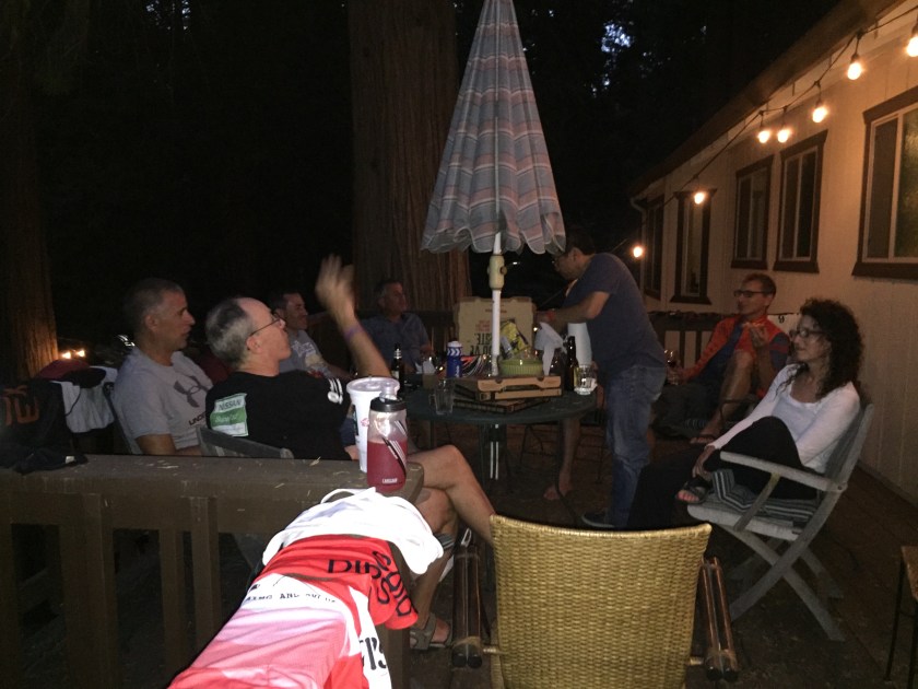
The next morning, after a hearty breakfast, we bid farewell to the group and the Ebbett’s Pass Century. . . we’ll get you next year!IMG_4292

Ebbett’s Pass Century

I’ve never ridden Ebbett’s Pass before, actually, I’ve never even driven it, but everyone I’ve spoken to insists it’s one of the most beautiful rides in the Sierra’s (especially the east side). When Mike B. suggested we ride it, AND graciously offer his cabin as a base, how could we resist?

There’s about a dozen Dips (and friends of Dips) that will be doing this ride, and it promises to be an awesome weekend of riding and revelry (riding first, then the revelry). Here’s the current list of Dips that are coming:

  1. Mike B
  2. Ron
  3. Tom
  4. Marty
  5. Susan
  6. Anna
  7. Jason (Susan’s friend)
  8. Paul
  9. Eduardo
  10. MJ
  11. Chris (MJ’s friend)
  12. Jorge
  13. Jeff (Anna’s friend)

If you’re going, or thinking of going, here’s a link to the Century website, but here’s some highlights:

  • 103 miles and 10,500 ft. of elevationEbbetts Century Elevation
  • 11 aid stations (that’s a ton!)
  • If you want to register, use the discount code EPCGUEST for 20% off
  • Usually includes a reserved spot in the following year’s Death Ride

Mike B.’s cabin is in nearby Arnold, about 3 hours drive from the Bay Area. Click here for a Google Map.

If you’re coming, here’s what you’ll need to bring:

  • Bath towel
  • Sleeping bag / pillow or whatever makes you comfortable at bedtime.
  • Sleeping pad if you have one
  • Bike stuff (Mike will bring a stand for any last minute issue need to be resolved)
  • Clothing for the ride; It will be in the high 40’s low 50’s to start, then 70’s -80’s toward the end of the day. (we pass by the cars mid-ride so we can unload clothing)
  • Sun block (mountain sun is intense)
  • Light jacket,  It will be cool Saturday morning.
  • Bathing suit and Beach towel if you are interested in staying for a swim at the lake on Sunday.
  • Snacks you like or would like to share
  • Drinks you like or would like to share
  • Breakfast of choice for the day of the ride

Mt. Tam Century Ride Report

On Saturday, Mike W., Susan and I woke up a couple of hours before zero-dark-thirty to head up to ride the Mt. Tam Century. As we drove through the city, incredibly dense fog had us worried that the ride (especially along the coast) would be cold, damp and windy.
We arrived to the Start at the San Rafael Civic Center to find a very well-organized event. There were an ample number of porta-potties, a manifold connected to a filtered water spigot for filling multiple bottles at a time, and professional signage that all had Marin Cycling printed on them (the race organizers). I believe this was the 55th Annual, so it’s obvious that these guys have gotten their act down to a science.

A first for me, we actually rolled out right at our start time of 6:00 am, likely a benefit to having a small group. The weather at the start was chilly, but dry and not much wind at all. The first part of the ride was working our way through Lucas Valley with a gradual climb and nice descent down to Nicasio Valley Rd. We were paced on the climb by a city truck that was laying cones for us riders; moving at just the right speed to march us towards to the top.

After a nice stretch of pacelining, where we pleased to find no headwind at all, we rode through Fairfax, which was my first time there. I thought it looked like a pretty cute little town, but Susan was quick to point out that it had been “overrun by hippies”. Quite a few riders stopped at a coffee shop that Mike was excited for, and I was sorely tempted, but decided we would push on; it was already going to be a long day without unplanned coffee stops.

At the top of Pine Mountain, we hit our first aid station, which was also well stocked and organized. They had NUUN on tap, which is what was already in my bottles from home, so there was no need to dig into my extra tablets in my jersey pocket. They also had croissants filled with Nutella; as a rule, I can’t pass up anything with Nutella in it, so I had two. Here’s a shot of the Dips kits getting ready to roll.

Pine Mountain Aid Station

As we waited in line for the porta-potty, a ranger with his siren on passed us with purpose, which is never a good sign. Once we rolled out, we only descended about a half-mile when we came on the scene of a rider that crashed out hard. They had him prone on the ground with his jersey off and were working on him; spooked, I think we all braked a little more on the rest of the descent.

At the bottom of the valley, as we passed over the dam at the foot of Alpine Lake, there was a spectacular view of the sun over the water, with the soothing sounds of bagpipes reverberating in the air. Not something you often see on centuries, there was a man, resplendent in his kilt (and Rayban aviators), standing on the dam and filling the valley with music as we passed him. You can see him in the background of this shot.

BagpiperAlpine Lake
As we pedaled away, the sound of bagpipes was replaced with the sound of our own breathing as we settled into the main climb of the day up Mt. Tam. As we ascended, I think we were all pretty pleased that the recent uptick in training was paying off, because the climb up Bolinas-Fairfax was actually pretty pleasant, and even the Seven Sisters couldn’t spoil our mood as we passed them on our way to the fire lookout. Here’s mike at the top of Bo-Fax getting ready for the Sisters.Mike_Top of BoFax

Once at the top, there wasn’t really much to look out on, as everything was blanketed in fog, not a reassuring sight, as we about to descend into it.

Fire Lookout
One group selfie before descending.

Dips at the topComing down Panoramic, it was cold, like Tunitas descent cold, except the air was more damp; but the road was dry, so with the exception of some numb fingers, all was good. In addition to the mist in the air, I was a little misty-eyed when I rode past the Dipsea shortcuts where it pops out onto Panoramic. And at Highway 1, as Mike and I waited for Susan to arrive, I stared longingly at the Stile, and I swear it was mocking me.

As a side note, Highway 1 is closed to the south at that intersection, and the thought of a future ride on the closed section of Highway 1 started to percolate. Later, we found out that the CHP routinely puts an officer at the washout on weekends to give tickets to riders who try it. Oh well, there’s always Big Sur!

Back to the ride, we headed past Stinson Beach, which was packed, despite the foggy weather, and stopped at Stinson Beach School for the next aid station. Although this one was still well organized, and had Nutella sandwiches for me, it was right across the marsh, from which was emanating a stench that made us eat and get the hell out of there.

Aid Station 2Aid Station 2a
It was shortly after we left that aid station and headed north on Highway 1 that things got interesting. Susan asked to stop because she was having trouble shifting into her big chainring; once stopped, it hit her hard, her Di2 battery was dying, and no longer had enough juice to shift her front derailleur.

For those of you not familiar with Di2 electronic shifting, as the battery drains, the first thing to go is your front derailleur. Once that happens, there’s a given number of shifts on the rear derailleur before the battery dies completely, and you’re stuck in the last gear you shifted to. The thing is, nobody knew how many shifts Susan had left, so we acted as if every shift would be her last.

Susan was in her small chainring, and just about her smallest sprocket, so I matched her gearing and we headed off to single-speed our way north. Lucky for us, I downloaded the course onto my Garmin, which meant that I could always see the upcoming elevation changes (about 2 miles out or so). We’d see a rise coming, and I’d check the elevation and see if it was worth risking a shift or not. We made it all the way to Point Reyes Station without shifting.

At Point Reyes Station, we stopped at a bike shop, but he didn’t have the ability to charge Susan’s system (first generation Di2), so we rode to the nearby aid station, resigning ourselves to the fact that we’d have to make it back with whatever battery we had left.
To Susan’s credit, the next stretch was basically a loop that does nothing but add miles, and takes you back to the same aid station. She could have hung out there for Mike and I, but not wanting to miss a mile just because she was “shift-limited”, she decided to join us. There was one climb that required us to use a few precious shifts on the ascent, and once back on the flat, a few more shifts to get into a high gear. We rolled that high gear back past the Pt. Reyes aid station (not stopping) and were pleased to know that there was only about 20 miles or so left, with rollers and a single climb back through Lucas Valley.

Sometime during the next 10 miles of rollers, Susan and I realized the benefit of single-speed training, as the knowledge of only having one gear really makes you aware of cadence and staying on top of your pedals, especially when approaching a roller. I think we actually ended up with a faster average speed for the last 40 miles of the century because of this.

Once we hit Lucas Valley Rd, it was a gradual climb over 3 miles or so where we were able to keep in our high gear, and once we hit the base of the true climb, we risked a few shifts down and held it until the summit. Again, I ended up climbing in a higher gear than I normally would have, and was still able to make it to the top. From there, it was a nice descent and flattish ride back to the car.

After we changed and were riding to the post-ride expo, Susan started shifting to see if she could find her last shift, but to her surprise, she still had battery left, and could actually have done much more shifting than we did, but agreed that it made the second half much more eventful. She promised to keep her Di2 fully charged from now on.

The food was great, with burritos, pizza, pulled pork and BBQ chicken; I had all but the burrito to add to my ice cold Coke . There was also Haagen-Dazs ice cream and gelato; Mike had both.

So a great day riding. It was Mike’s first century, and he did great. The weather was really just a factor on the descent from Mt. Tam and the first part of Highway 1, but was otherwise spectacular. Susan commented that it was like the tale of two rides. The first, hilly and full of climbing, the second, rollers and long flat sections.

Mt. Tam Century Course

Next stop. . . Ebbett’s Pass!